|
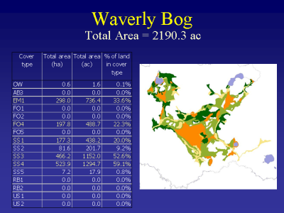
Slide 26: Waverly bog is a large wetland complex with a large needle-leaved evergreen and broad-leaved evergreen shrub component.
|
|
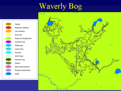
Slide 27: It is located totally on the private land of two landowners and is classified as Resource Management, the most restrictive private land use classification in the Park.
|
|
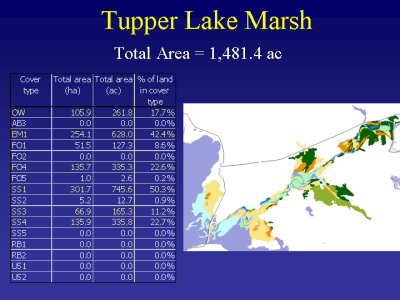
Slide 28: Tupper Lake Marsh is one of the largest emergent / riparian hardwood forest wetlands in the Park. It is seasonally inundated by flood waters of the Raquette River. The riparian hardwood forest is dominated by Acer saccharinum perched on labrynthine parallel arcing levees created by the annual rise and fall of the river waters.
|
|
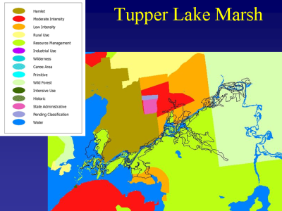
Slide 29: The marsh is bordered to the south by Resource Management lands and to the north by Hamlet (the least restrictive land use class) and Low Intensity. A large portion is State owned Wild Forest.
|
|
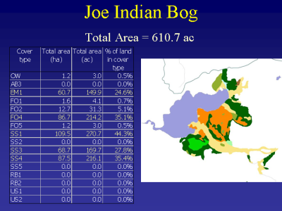
Slide 30: Joe Indian Pond was created by a dam and is part of the extensive hydropower network of power producing and feeder dams on the mid-Raquette River. Complex topography within the wetland determines the location and extent of the coniferous forested and broad-leaved evergreen wetland components.
|
|
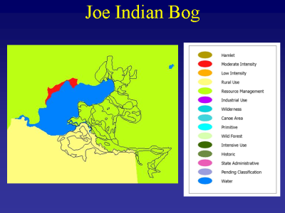
Slide 31: Joe Indian is divided by two land use areas, Resource Management and Rural Use, the most restrictive private land use categories. Note also the moderate intensity on the north shore of the pond where intense camp and second home development is occurring.
|
|
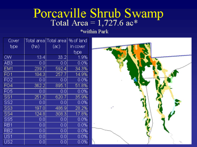
Slide 32: The Porcaville Shrub Swamp is actually quite a bit larger. The blue line of the Park cuts it in half. The portion in the Park is a complex interdigitation of broad-leaved deciduous shrub and coniferous forested swamp that is subject to annual inundation. Note also the large area of broad-leaved evergreen shrub swamp on the border.
|
|
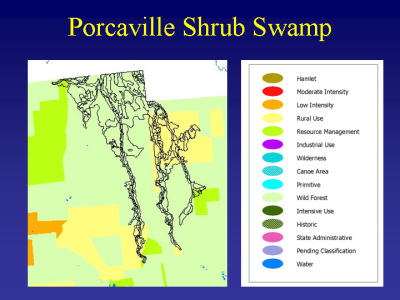
Slide 33: Porcaville has perhaps a more complex land classification than the others. It has a mix of State Wild Forest Lands, and Private Rural Use and Resource Management. Much of this wetland outside the Park is on State Forest lands and is managed for timber.
|
|
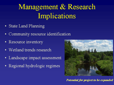
Slide 34: Management and research implications.
|